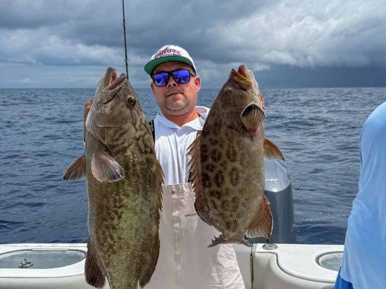
Philosopher Sir Francis Bacon in 1597 famously opined, “Knowledge itself is power.” For anglers, this truism carries intense meaning when pursuing pelagic fish like billfish, mahi, tuna and wahoo. Offshore fishermen are constantly seeking information, poring over internet reports, calling tackle shops, and networking with core groups—all to find out where fish might bite tomorrow. Today, however, there’s even more insight available, thanks to two advanced fish-forecasting technology services, including Simrad’s new FishCast powered by Roffs and Fish Mapping from SiriusXM Marine. Let’s look at these two systems to see what kind of power they can give you.
FishCast
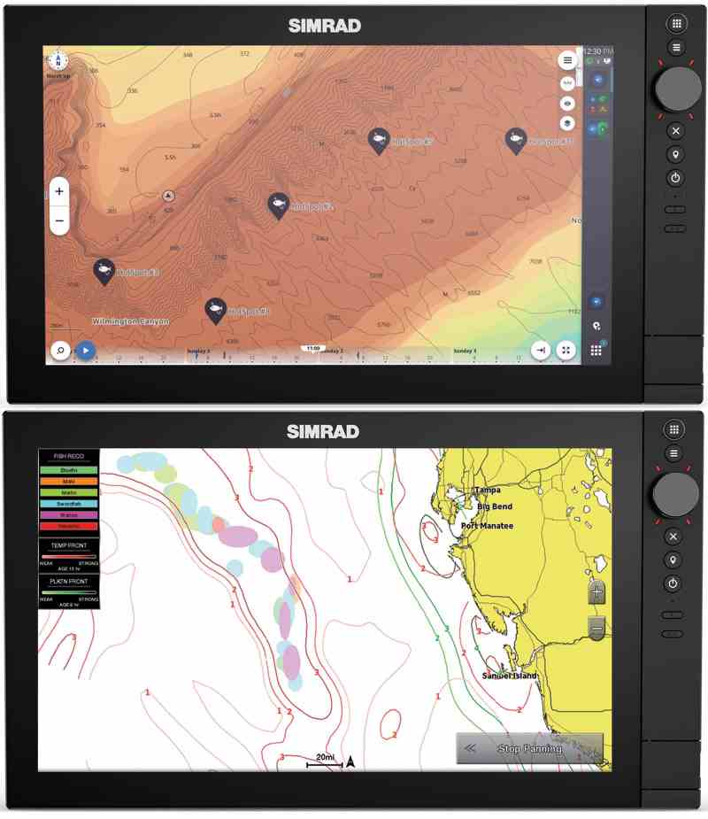
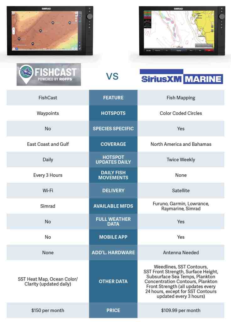
FishCast powered by Roffs is a new system that integrates with C-Map electronic charts to create an overlay on select Simrad MFDs. FishCast was developed for Simrad by Fathom Science. The company has access to detailed real-time oceanographic data, the same kind of data tapped by commercial ships and offshore oil-platform operations. By partnering with Roffs—the popular satellite fishing forecast service—Fathom Science also has extracted more than a decade of bluewater angling data. This is then combined with oceanographic intelligence to offer AI-enabled offshore maps forecasting optimal catch locations provided as charted GPS waypoints. FishCast also includes forecast heat maps of Sea Surface Temperature and Ocean Color/Clarity.
This data packet is updated every morning with a three-day forecast divided into three-hour windows that forecast how conditions will change and where fish will likely move throughout the day. Anglers can define a custom search radius of up to 120 nautical miles from a selected home port.
These forecasts are designed to be downloaded to a compatible Simrad MFD via Wi-Fi before you head out using the marina internet or via a satellite internet service such as Starlink. It can be selected by region for 18 states along the East Coast and Gulf, as well as the Bahamas.
To access FishCast, you need a subscription, starting at $99 for a week, $150 per month or $1,260 annually. You can set up FishCast directly on your Simrad MFD (with software version 2.3 or later) using Wi-Fi and the C-Map X-Chart Manager app. Alternatively, you can subscribe online at xstore2.c-map.com.
Fish Mapping
The popular Fish Mapping features from SiriusXM Marine are provided by Garmin, a world-wide leader in GPS-enabled devices and technology. Garmin’s team of oceanographers analyze data layers from multiple sources to identify fishing hot spots, leveraging over 30 years of oceanographic, commercial and sportfishing experience. It combines this information to generate timely, easy-to-understand offshore analysis delivered to your MFD via the SiriusXM Marine satellite network at any time to help guide you to fish. You can also download the information on the Fish Mapping app via cellular or Wi-Fi to help plan trips.
Fish Mapping includes eight key elements on your MFD: Fishing Recommendations map (updated twice weekly) with color-coded circles highlighting hotspots, Weed Lines (every 24 hours), Sea Surface Height Anomaly indicating upwellings and convergence zones (every 24 hours), Sea Surface Temperature Contours (every 3 hours), Sea Surface Temperature Front Strength (every 24 hours), Subsurface Sea Temperatures at 30 meters (every 24 hours), Plankton Concentration Contours (every 24 hours), and Plankton Front Strength (every 24 hours), with more features available on the app.
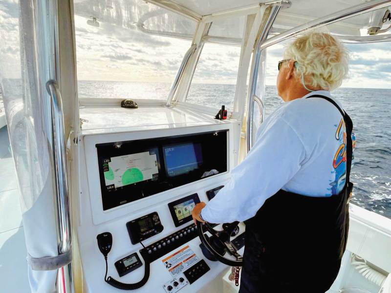
Because Fish Mapping insight is delivered through an onboard MFD via the SiriusXM Marine satellite network, it is accessible just about everywhere, even far offshore. As with the popular SiriusXM Marine weather service, Fish Mapping does not require internet or cellular service, but it does need a separate compact antenna that fits easily on a center-console boat or an inboard sportfisher.
Fish Mapping is compatible with MFDs from major brands such as Furuno, Garmin, Lowrance, Raymarine, and Simrad. Each one requires a specific antenna system to enable satellite reception. Fish Mapping covers all US coastal waters (over 150 miles offshore from the contiguous US), as well as the Bahamas.
Read Next: Using the Latest Sonar Advancements to Find Fish
To access Fish Mapping, you need to subscribe (siriusxm.com/fishmapping). The monthly fee is $109.99, plus $25 activation fee. It includes the popular SiriusXM Marine Offshore Weather package. The subscription can be suspended for up to six months each year if, for example, you don’t need it in the offseason.
With either of these systems, you have access to more knowledge, and therefore more power than any offshore angler has possessed in the history of sport fishing. It’s the kind of knowledge that leads to great success. Sir Francis Bacon would be impressed.