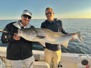
Many are treasured fishing spots that I expect to hand down to my kids, who might then pass them down to their own kids.
If these waypoints were ever lost, I would be crushed, and I imagine many others feel the same about their spots. That lends impetus to the need to wisely manage and archive such electronic data to help ensure it will not mysteriously disappear into the ether one day.
Wise waypoint management extends to how you organize the data. That might be about as scintillating as filing a tax return, but ongoing organization of waypoints makes you more efficient in returning to productive structure to find fish.
Name Game
I learned back in the days of loran-C and TD coordinates about the importance of naming your waypoints. On those occasions when I forgot to assign a name, I’d struggle to recall the waypoint for a newly discovered hot spot. I took to jotting down the numbers and names on the helm panel in grease pencil.
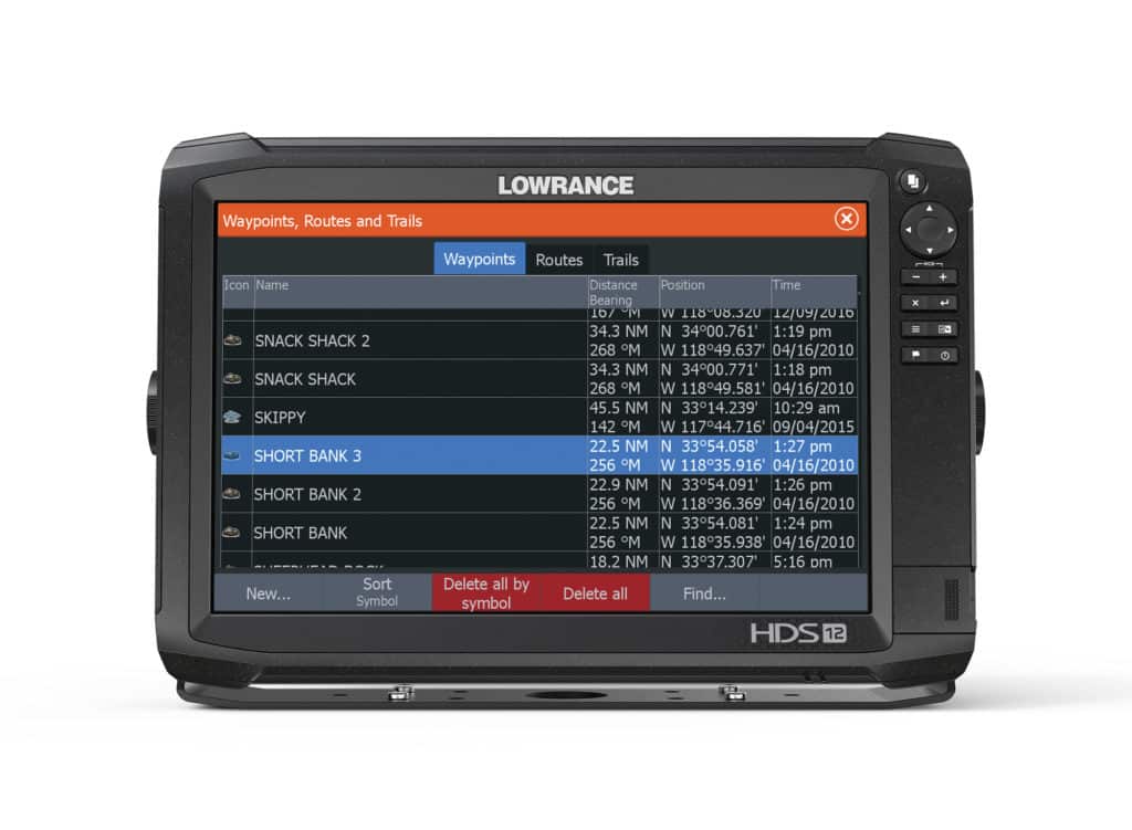
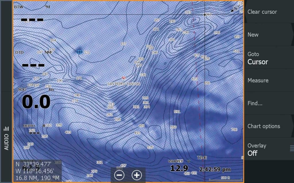
It’s a little different in the age of GPS and chart plotters, which are often now integrated into MFDs. You can scroll across the electronic chart to the area where you were fishing and zoom in to find that particular waypoint. Yet it’s still a good idea to assign names to your waypoints using the machine’s edit function. It makes them easier to recall and find than using the numbers randomly assigned by the plotter.
Refer to the owner’s manual for your particular chart plotter to learn how to edit waypoint names. With a touchscreen, it’s as easy as typing in a name on your smart device.
I like to assign some significance to a spot. For instance, one of my favorites is Grant’s Reef, so named because I first fished it with my youngest son, Reef. That’s a joke. His name is Grant.
Waypoint names also facilitate easier, faster searches using the Find function on a chart plotter. Just type in the first few letters of the waypoint’s name, then press enter. Spots with monikers beginning with those letters will come up in a list.
Take Notes
Most chart-plotter systems also let you include notes. Garmin’s GPSMap 7400/7600 series, for instance, allows you to edit a waypoint listing to add or revise a comment about the spot. Check your owner’s manual to learn how you might add notes on your own plotter.
I use this function as a reminder of key details about the spot, including the depth, type of structure or bottom composition, the amount of relief to the structure, prevalent species, most productive tides, and more.
It requires a bit more time to add notes, but I like to complete this chore as soon as possible while all the details are still fresh in my mind. I also update the notes occasionally, especially when the spot produces an unusual species, or when I find out something new about the area designated by the waypoint symbology.
Read Next: How to Use the Chartplotter’s Tracking Function
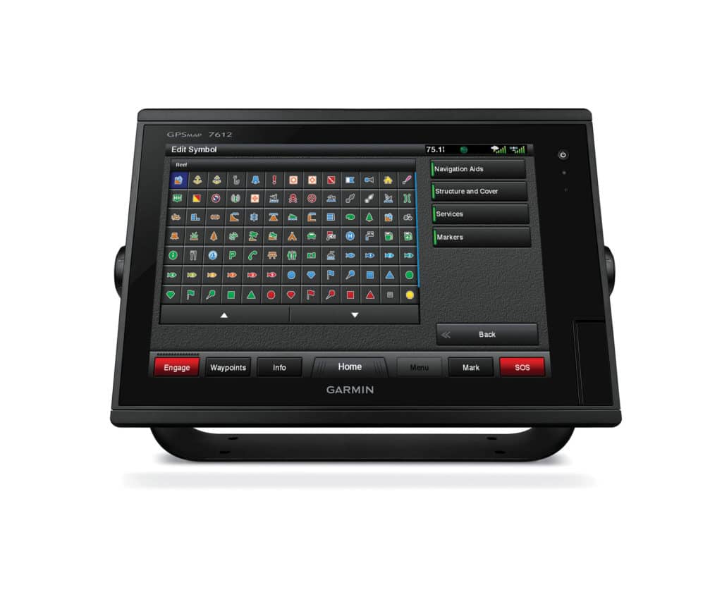
Many systems offer a choice of symbols you can assign to a waypoint to help you quickly identify the type of spot. On the Lowrance HDS Carbon series multifunction displays, you can choose from among 70 different symbols, including rocks, wrecks and fish.
There are also waypoint symbols related to navigation and general boating, such as buoys, day boards, anchorages, boat ramps and fuel docks. Categorizing your waypoints helps you distinguish the fishing spots from navigational waypoints.
Some chart plotters let you color-code waypoint symbols. I use this to separate structure spots that historically produce best when the current is running northerly (color-coded in blue) from those that produce better when the current is running southerly (color-coded in red). You might want to use color-coding to indicate other factors, such as depth or the most prevalent species.
Back Up!
In the early days of waypoint collection, I kept bearing books and dutifully transcribed the TD coordinates and, later, the latitude and longitude of my waypoints.
Today, my bearing books are safely tucked away, collecting more dust than salt spray, thanks to electronic archival systems that allow for the easy extraction, storage and retrieval of digital waypoint data.
Back up your waypoints about every two or three months or whenever you find a hot batch of new spots. This ensures that new waypoints won’t vaporize should your chart plotter melt down, get stolen or meet an untimely destruction.
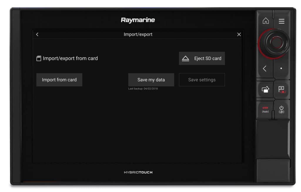
Again, check your operating manual for the backup process. With Raymarine models you insert a memory card in the card-reader slot of the unit and copy the waypoint list to the card via menu selections. Put the card in a safe place after you remove it. You can also copy the file to your home computer to ensure a secondary backup.
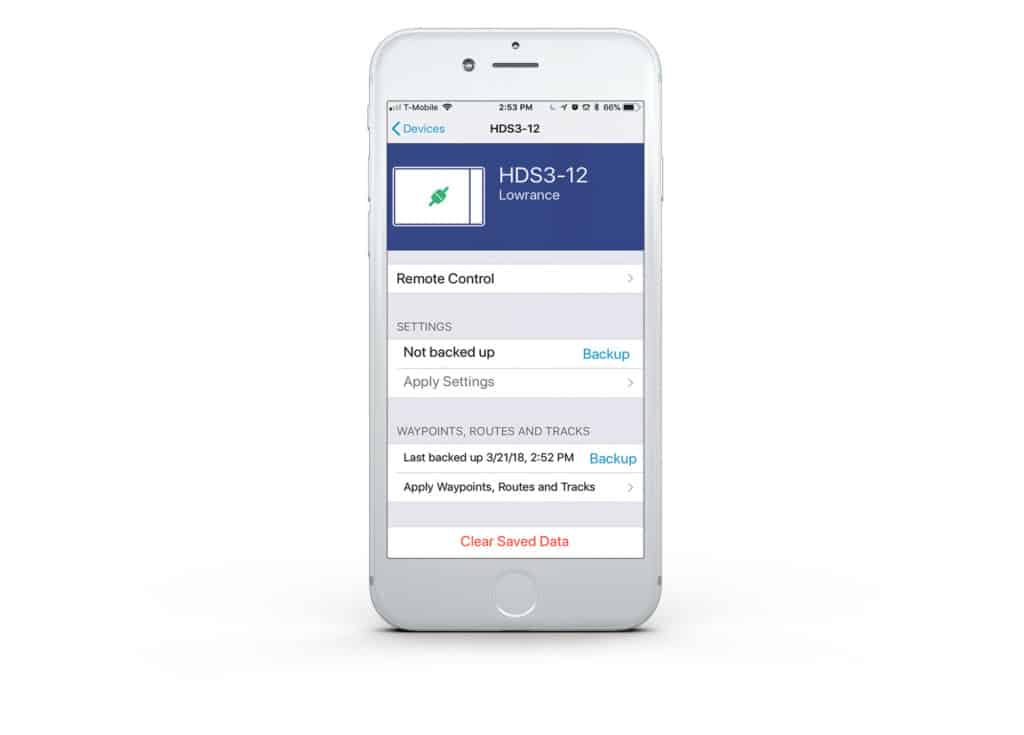
Some chart plotters wirelessly back up files. The Link app for the current Lowrance and Simrad MFDs, for example, copies waypoints, routes and tracks directly to a mobile device.
No-Trauma Transfer
Having a backup file also simplifies the process of populating a new chart plotter with your waypoints. In years gone by, you were saddled with manually entering the numbers and names in the new unit. Today, however, you can electronically transfer the waypoint data to the plotter with the backup card or wireless app. You’re done within minutes.
Thanks to advancing digital and wireless technology, wise management of your priceless waypoint collection is easier than ever.