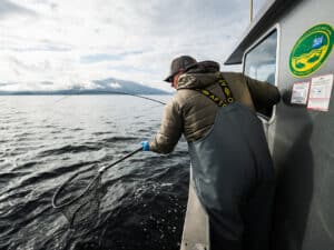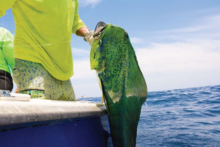
One thing I’ve learned in my years as a boating angler is that attempting to engage in an unfamiliar fishery can seem like a daunting proposition. And when it comes to saltwater fishing in Southern California, the striped marlin tops the list of fish that people assume is too difficult to learn how to target, so much so that many boating anglers don’t even try. The thing is, striped marlin aren’t difficult to catch, they are just hard to find because there aren’t huge numbers of them in SoCal at any given time. The good news is that by combining today’s modern charting technology with a basic understanding of striped marlin behavior, they’ve never been easier to find.
Striper Season
Before we get into the details of where to find these marlin, it’s important to focus on the when and why of this sport fishery. Striped marlin (aka stripers) visit Southern California waters during the summer and fall. While there are exceptions, they usually arrive in late summer and will remain until water temperatures drop in autumn, with September historically being the best month.
Unlike the other gamefish in SoCal waters, which usually follow warm water up from the south, striped marlin come in from the west. Due to that, marlin can show up anywhere from the Channel Islands archipelago to below the Mexican border, but their typical pattern is to first arrive near Santa Catalina Island or around the offshore banks southeast of the island. At some point during the season, the fish will make their way up the line to Santa Barbara Island, and they usually end up around Santa Cruz Island or Anacapa Island in the Channel Islands chain. The amount of time they spend in any one area is dependent on water quality and forage.
In 2024, the bulk of the biomass stayed around Santa Catalina Island, and the fish bit for an extended period due to stable water conditions. The previous year, most of the fish caught were around the Channel Islands, but the bite window was shorter due to fluctuations in water temperature. In a nutshell, striped marlin have an uncanny ability to find the best water conditions around and will post there until the conditions deteriorate. During the 2015 El Niño, there were marlin biting after Thanksgiving in a small bubble of warm water off Santa Barbara Island. The moment the water cooled, the fish headed to where they came from.
Warm and Clean
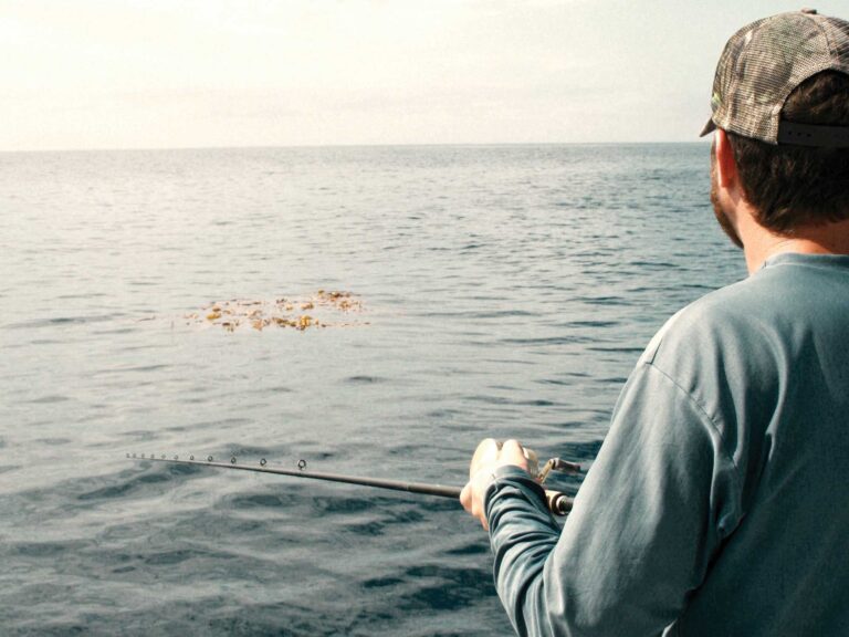
Striped marlin like warm and clean water. By clean, I mean purple-blue offshore water. Stripers especially like when clean water abuts a current break with dirty, greenish water on the other side, areas where different currents interact to create eddies that trap chlorophyll and the zooplankton that feed on this. In turn, the zooplankton attract baitfish, which filter-feed and convert the microscopic animals into protein large enough for marlin to consume.
While these current breaks are sometimes formed over featureless bottom topography, they are more often associated with topographical features, like undersea banks or islands rising up from the seafloor. The depth changes created by these features cause currents to speed up and create turbulence. It’s similar to what happens when you put your thumb over a garden hose—the same amount of water is moving through, but blocking part of the opening causes it to spray out. While ocean currents are not nearly as dramatic as that, they are powerful enough to create the eddies that trap nutrients and attract fish.
Shady Advantage
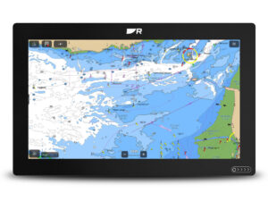
Regardless of which island or undersea bank marlin might visit, once you understand what to look for, it’s easy to figure out if you’re in the right spot using today’s technologies. Recent advances in electronic charting technology have changed the way we look at the seafloor. Gone are the days of trying to decipher what the fathom curves on a chart indicate. Now, thanks to high-definition shaded-relief electronic charts from companies such as C-Map and Garmin Navionics, we can visualize the seafloor.
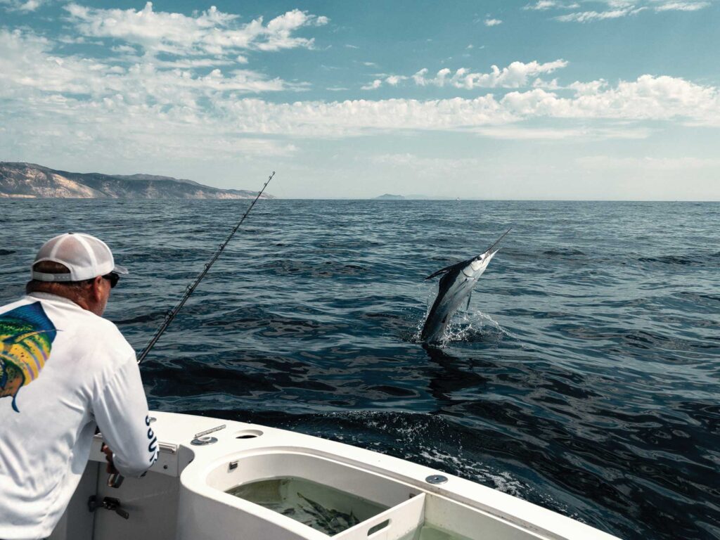
Seeing what the bottom actually looks like using these advanced charts gives you the ability to relate what you’re seeing on the surface and your fish finder. Going back to my example of a clean-water current break, if it’s related to a piece of structure, you can follow that topographical feature in search of signs of life. While you’ll rarely see a marlin on the fish finder, you can tell when you’re in the right zone once you start seeing baitballs on sonar or seabirds such as terns working the area intently. On a trip a few years ago, I was approaching the 152 (a bank southeast of Catalina) and saw some terns working. Instead of proceeding on toward the bank, I put the trolling lures in, and five minutes later, we hooked a marlin. That fish was in the middle of nowhere, but the terns looked too good to pass up.
Likely Hotspots
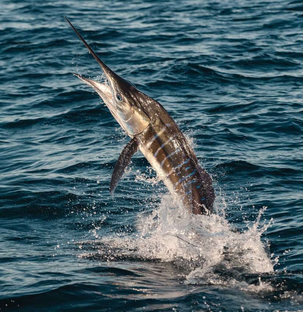
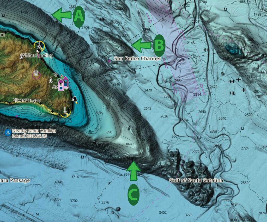
With an understanding of the conditions and signs to look for when fishing for striped marlin, let’s talk about where to find them using the image of the shaded-relief chart on the previous page. Marlin will often relate to the area where an island begins to rise up from the seafloor (indicated with arrow A) because this is a place where the change in water depth creates the feeding scenario mentioned earlier. They consistently relate to a particular depth along this fathom curve, and they will be where the food is, sometimes found in surprisingly shallow water. Last season, I saw a marlin feeding on small bonito in 100 feet of water off the backside of Catalina.
When looking for marlin along these fathom curves, it helps to drive in a zigzag manner until you find an area with baitballs on sonar or signs of life on the surface. Once you get to the magic depth, you can troll along that fathom curve and hopefully get a bite. Something to keep in mind is that the areas with signs of life don’t usually continue the length of the island, so it’s important to pay attention to what you’re seeing. Once the signs of life dissipate, turn around and troll back through the area.
Once you figure out the extent of the zone, you should focus your attention on trolling through it at different directions, making sure to thoroughly cover the area. It will often take quite a bit of driving back and forth before you get a bite, but pay attention to what you were doing when you got that bite so you can repeat the process. A good rule of thumb is to never troll directly up or down a swell, and if the sun is low, try to keep it behind your trolling lures so the shadow of the boat doesn’t give away your presence to the fish.
Read Next: Marlin on Fly

Bank Visit
Arrow B indicates the Avalon Bank, a popular high spot near Catalina that fishes like every other submerged bank. While most anglers’ inclination is to start at the high spot of the bank, most marlin tend to hang out on the edges, where the turbulence in the current attracts baitfish. During summer months, current usually runs south to north here, so the south end of the bank is the most likely area to hold bait. However, this is not always the case, so start there and look for bait and birds while trolling around the outside edges of the bank, with an occasional pass along the top of it.
The final scenario, indicated by arrow C, shows where the end of Catalina Island comes up from the seafloor. Areas such as this fish like a combination of examples A and B. In this scenario, it makes sense to start at the bottom end and work up the sides while looking for signs of life. Once you do find life, you can troll back and forth across the bank in that depth range. Sometimes that life might be located a mile or two from the end of the island, and other times it can be just a couple hundred yards away from land. Marlin only care about where they can find food, so don’t worry about being too shallow or deep.
When fishing any of these areas or structure types, your best shot at catching a marlin is going to come on the slack high or low tide. So, it’s important to keep an eye on your tide chart and make it a point to be in the best-looking area you’ve found when the tide goes slack. As I mentioned in the beginning, the hardest part about marlin fishing is finding them in the first place; once you’ve got that figured out, you’re most of the way home. There is a lot of information available online about the tackle and lures you’ll need to catch fish, but my advice is to just keep things simple—put a couple of marlin trolling lures (jigs in SoCal nomenclature) and have a live mackerel ready to drop-back to a fish in the spread or to cast at a fish on the surface. Once you’ve got that done, get someone with a pair of stabilized binoculars to watch what’s happening around you closely. And just like that, you’re marlin fishing.