Get ready to drop, we’re just about there,” said friend and longtime mentor Jim Hendricks. His eyes were glued to the screen of his multifunction display, the screen split to show both his chirp sonar and C-Map Reveal shaded-relief chart. Just as the chart display showed our boat nosing toward the edge of a small rock, the sounder display indicated the bottom was getting harder and coming up a few feet. After idling forward a few more feet and then bumping the boat in reverse to slow our slide, our lures were headed to the bottom.
It didn’t take long for my “donkey rig”—two 1 1/2-ounce Hookup Baits tube lures rigged in tandem—to reach the subtle piece of structure 120 feet below us. The one-two punch came on the second gentle jigging motion of the rod tip, the 7-foot graphite rod doubling over, and the spinning reel begrudgingly spilling braided line under the heavy pressure of two 5-pound barred sand bass.
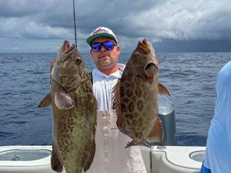
Catching one fish of this class over a day of fishing off the Southern California coast is a noteworthy achievement. Having two of them on the line at once qualifies as an embarrassment of riches. However, this is the kind of experience you can expect when you focus on fishing small structure spots that other anglers might overlook.
It isn’t that these small chunks of structure are more appealing to big fish. These otherwise hard-to-find spots do, however, get far less fishing pressure. While the main part of a big wreck or reef can sustain a much larger biomass, smaller outlying structure areas seem to be the realm of one or two “home guard” fish that rule their little neighborhood like a couple of bullies. The first bait or lure in the zone seems to inevitably be snapped up by an XL-size calico bass, sand bass, sheephead or whitefish.
This is not just a Southern California phenomenon. Other coastal anglers are learning to target small structure spots when fishing for species such as amberjack, grouper, snapper, striped bass, and other fish that relate to structure or hard-bottom habitats.

The Shaded-Relief Revolution
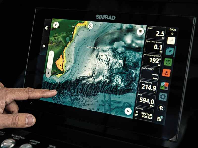
The key to unlocking the smallest rock piles, reefs and other bits of small structure is the latest generation of shaded-relief electronic charts, including C-Map Reveal and Reveal-X, Navionics Platinum+, Garmin G3 Vision and GN Vision+, Humminbird Coastmaster, CMOR and StrikeLines.
All shaded-relief charts begin with raw data, the majority collected through hydrographic surveys conducted by the National Oceano-graphic and Atmospheric Administration and its subsidiary agencies. These surveys, along with some private sources, provide a wealth of accurate data on the seafloor and its many irregularities. It’s how this data is processed and presented that makes shaded-relief charts so valuable to anglers. Shaded-relief charts are high-resolution electronic charts that use a combination of color and varying degrees of shadow to create a three-dimensional appearance. The more prominent the shading, the higher the amount of relief.
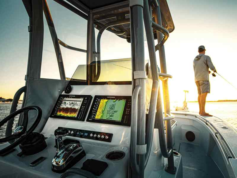
This shading effect makes it easy to locate isolated structure on the chart—the type of small habitat that big fish like to call home. Key West charter captain Chris Trosset knows this, turning to a list of small structure spots he’s accumulated when after large red grouper, mutton snapper and other bottomfish. Trosset uses C-Map Reveal charts on his Simrad NSO24 MFD, its massive 24-inch display allowing him to search and set up on small spot other anglers probably miss. “There is so much detail, I’m able to get set up correctly on even the smallest spots. I want to fish just off the structure on the sand so I can land bigger grouper without getting rocked.”
Laptop Research
Fishing author and Chesapeake Bay native Lenny Rudow also focuses on small, off-the-beaten-track hard-bottom spots when targeting large striped bass and keeper black sea bass. But he does it with a twist. Instead of using an advanced chart with shaded-relief capabilities, Rudow searches out potential spots using his office computer and NOAA’s bathymetric data viewer website (ncei.noaa.gov/maps/
bathymetry). He uses the latitude and longitude numbers from the NOAA site in his boat’s Humminbird Apex 16 MFD, then further investigates the promising real estate with the chart plotter and sonar. Anglers who plan on using the NOAA site in this manner must activate the site’s DEM color shaded-relief feature to get the full effect. Shaded-relief coverage can be spotty, but it’s worth using this online tool to search your region for these tiny treasures.
Whatever MFD or chart-plotter brand you run, there is likely one or more shaded-relief electronic chart platforms you can try out. Think small, and you might just find yourself catching more big fish than ever before.
Shaded-Relief Charts
- Garmin: garmin.com
- Navionics: navionics.com
- C-Map: c-map.com
- CMOR Mapping: cmormapping.com
- StrikeLines Charts: strikelines.com