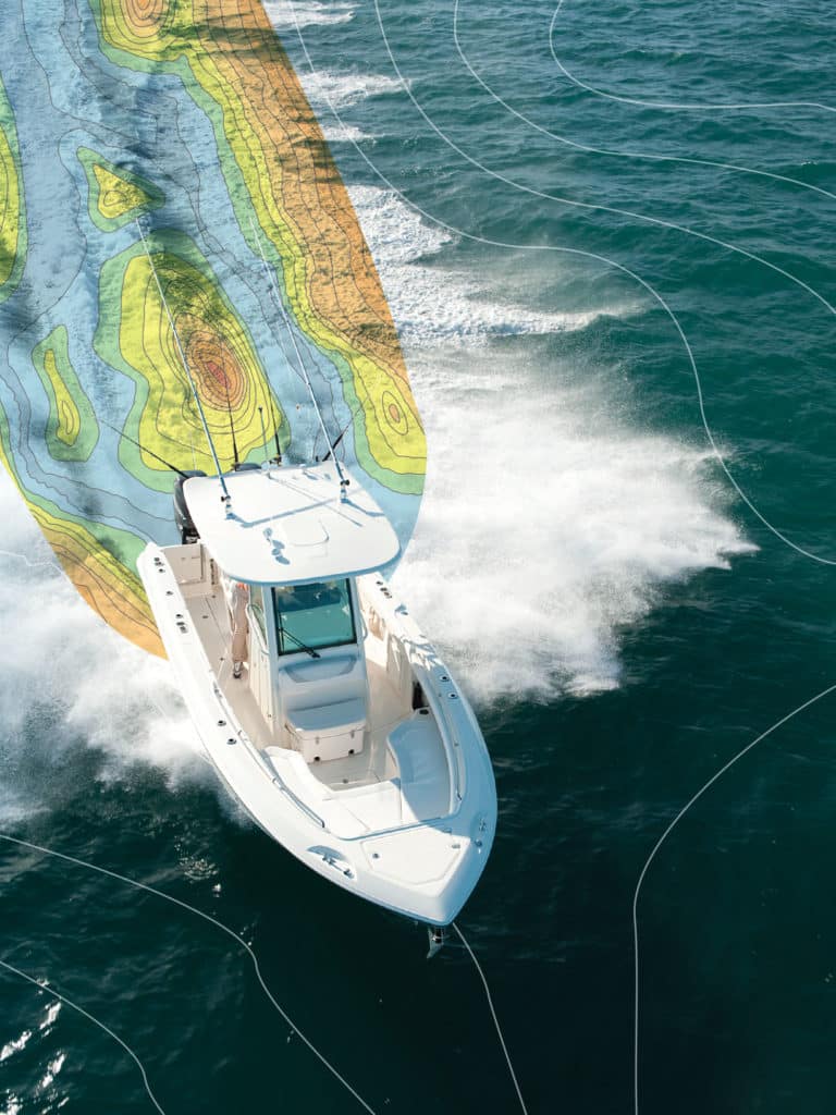
I joined Capt. Ron Mitchell at the helm of Bandit, his 39-foot Sea Hunter center console, as we approached a wreck 20 miles off Marco Island, Florida. A waypoint icon on the plotter served as the only indication of fish-holding structure, but that was about to change right before our eyes.
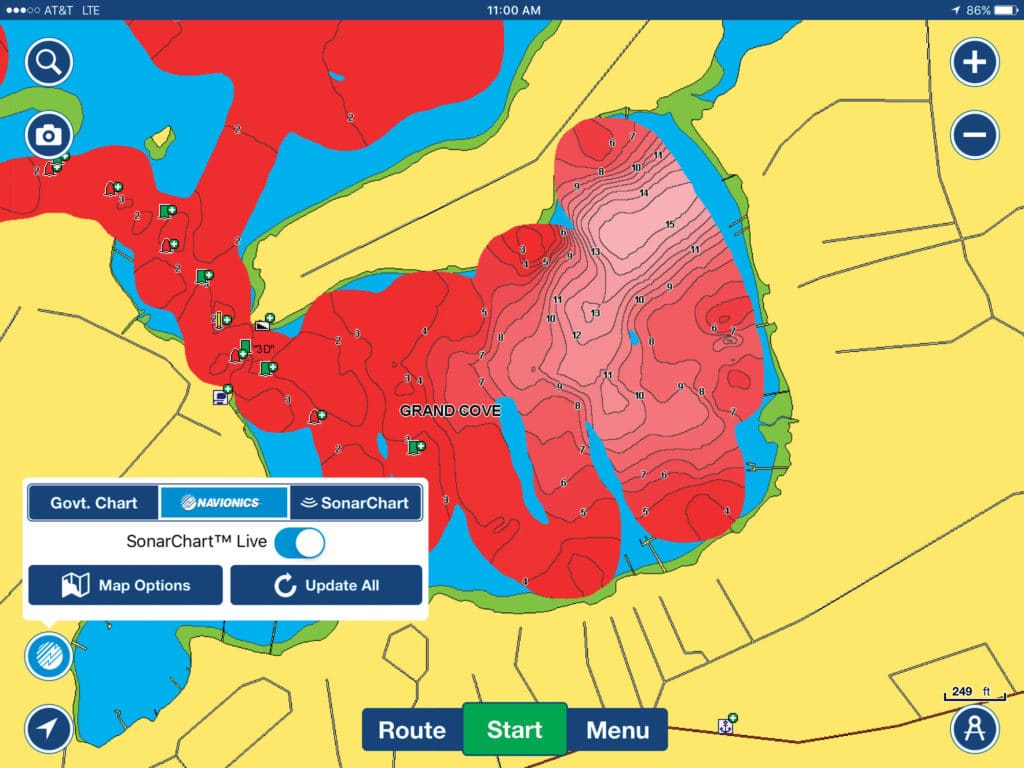
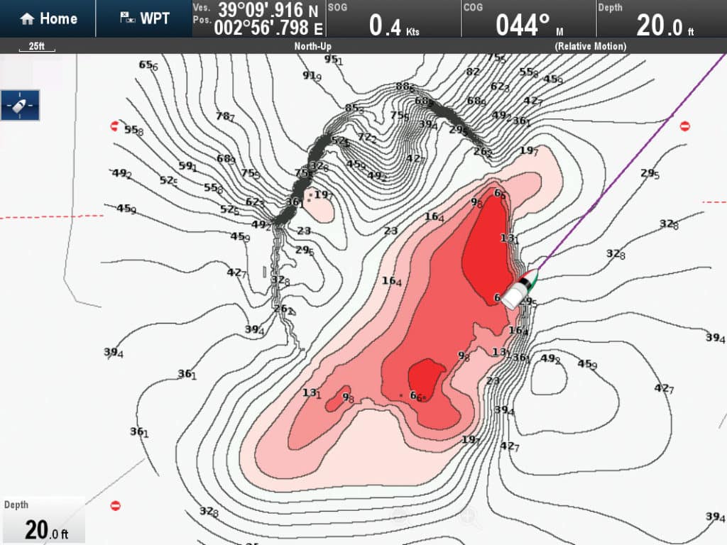
That’s because we were using Navionics SonarChart Live in conjunction with Mitchell’s Raymarine gS165 multifunction display (MFD), and what had been a featureless screen soon began to fill with contours in 1-foot increments, outlining intricate details of the structure below.
As we crisscrossed the area with sonar, the veteran captain got to see the wreck in full detail and high definition for the first time as it emerged almost magically on the plotter screen. He also discovered and charted clumps of debris scattered as far as 75 feet from the wreck’s main hull.
For more fishing electronics coverage, read about the improvements in radar technology.
Visual Effects
“This technology offers instant gratification,” says Shaun Ruge, product manager for Navionics. With programs like SonarChart Live, you can record the details of wrecks, reefs, channels and ledges in real time. Which, in turn, lets you target fish more effectively, Ruge points out.
At least three brands of marine electronics now integrate easy-to-use, real-time charting capabilities: Humminbird with AutoChart Live, Garmin with Quickdraw Contours, and Raymarine with Navionics SonarChart Live. Existing MFDs might require operating-system upgrades (usually free online) to enable live charting, but most new models include the necessary software.
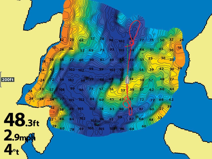
Activating live-charting functions is as easy as pressing a few buttons on a touchscreen menu. With Garmin’s Quickdraw Contours, for instance, you press “Menu,” then “Quickdraw,” then “Start Recording.” Depth contours are selectable down to 1-foot increments. Readings are captured as an independent file (either on the chart card, a separate data card or internal memory) and displayed as a layer over supplied chart data. In other words, the personal chart you create does not alter the underlying chart. You can make the live-chart overlay semitransparent, which allows you to read the chart data underneath — an important feature for safe navigation.
No Processing
Do-it-yourself electronic charting has been around for a few years. Programs such as Insight Genesis (for Lowrance and Simrad MFDs) and Freshest Data (for Navionics-compatible MFDs) enable you to create a sonar log that’s cross-referenced with GPS coordinates. Typically, you upload the sonar log to a website for processing, then download the processed data to use in your MFD. Humminbird’s AutoChart software lets you process files in your computer.
Live charting dispenses with this and, according to James McGowan, Raymarine marketing manager, is the wave of the future. “In processing files, there can be a lot of steps and waiting time,” McGowan says. “Plus, you’re not really sure what you are going to get.
“With real-time charting, you know immediately what you are getting,” he adds. “Best of all, you can put the new chart detail to use instantly.” Live charting also saves you money, says David Dunn, senior manager of marine sales and marketing for Garmin, the company that offers live charting via Quickdraw Contours on compatible Garmin MFDs. “Since you’re adding new HD chart data all the time, you don’t have to buy updated chart cards as often,” he points out.
The use of Quickdraw Contours and AutoChart Live is free, but Navionics currently requires a $99 annual subscription to its Freshest Data club and at least one chart update every 12 months to establish eligibility to use SonarChart Live, Ruge says.
Keep It Secret
Unless you choose to share through a crowdsourcing website such as Freshest Data or simply hand your charts over to others, whatever charts you create belong to you alone. To prevent automatic wireless uploads with Navionics SonarChart Live, you just need to unclick the “Upload Logs” function in the Raymarine menu.
Live-charting systems can tap any networked sonar source. Aboard Mitchell’s boat, we used a Raymarine CP470 CHIRP sonar, yet you can also use a conventional 50/200 kHz sonar or a scanning sonar. Garmin recommends using its Panoptix real-time sonar for the highest definition, though any of Garmin’s sonar systems will work, according to Dunn.
No matter what sonar you use, slow is the way to go. “You can record with AutoChart Live at speeds of 20 to 30 mph,” Humminbird’s Carson says. “But at those speeds, there will be gaps.” To create a complete outline of the seabed, go slow and make several passes, he advises.
You can add depth shading, which enables you to easily focus your fishing efforts within a key depth range. “I can’t emphasize enough how helpful depth shading is in targeting fish such as stripers along a drop-off,” Carson says. You can also generate labels to identify productive spots to further personalize your chart.
Relatively inexpensive, instantly ready and easy to use, integrated live-charting technology is destined to become as commonplace on fishing boats as chart plotters. Anyone who adds this tool to his arsenal of marine electronics can become a better angler right away.
Live Charting with Furuno
Furuno offers the capability of real-time chart creation. It requires the addition of a Timezero Personal Bathymetric Generator module ($500) and Timezero charting software ($1,250), and is compatible with Furuno’s NavNet TZtouch and TZtouch2 displays with networked sonar sources.
Live-Charting Choices
Three marine electronics brands have integrated easy-to-use live-charting capabilities into their multifunction displays, allowing you to instantly create personalized charts and more effectively target fish on wrecks, reefs and ledges.
Humminbird AutoChart Live
Compatible Charts: C-Map, Lakemaster, Navionics, Zero Line Card Compatible Displays: Helix, Ion, Onix series
Garmin Quickdraw Contours
Compatible Charts: BlueChart g2, BlueChart g2 Vision, LakeVu HD Ultra Compatible Displays: EchoMap, GPSMap 7400/7600, 8000/5×7/7×1/8×10/10×0 series
Raymarine SonarChart Live
Compatible Charts: Navionics+, Navionics Update, Navionics Platinum Compatible Displays: a, c, e, eS, gS series


