Leaps forward in marine electronics are a wonderful thing, but they are never so good as when they come bundled in a plotter/fish finder combination that installs easily, fits the available space at the helm, and puts the latest bells and whistles to work getting you into fish.
Graphics, cartography, 3-D display, integration, and overlay capabilities – weather, radar, AIS – continue to gain sophistication, and most manufacturers, to their credit, are putting these technologies into their most modestly sized and priced plotters.
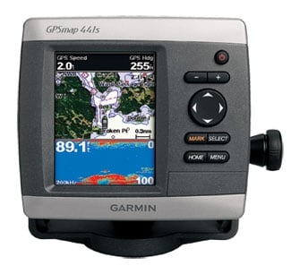
**Garmin **has revamped the popular **400 and 500 series **stand-alone combination plotters. “They have been around for a while and were due for an upgrade,” says Greg DeVries, Garmin’s director of marine sales. “Revamps like DSC, autopilot functions and NMEA 2000 cannot be done by software alone.”
The most noticeable improvement involves the speed of the processors. “They have bigger motors,” says DeVries, “and zooming and panning is smoother.”
The 4-inch, 400 series plotters are priced from $499.99 to $699.99; the 5-inch, 500 series plotters run from $699.99 to $899.99; and the 5X6 plotters range from $899.99 to $1,199.99. All feature a new high-sensitivity GPS receiver for faster acquisition times and superior tracking. They are also NMEA 2000 compatible. Each model comes with preloaded cartography: worldwide base map, U.S. inland lakes or U.S. coasts. The 400S and 500S versions come with 500-watt sounders, good to 1,500 feet, and the 5X6 models come with a 1,000-watt sounder, effective to 2,000 feet. All incorporate Garmin’s new version 5.0 software.
“We are trying to add enough to these chart plotters so that we are able to give the fisherman on a 15-foot boat the same experience as the one on the 46-footer,” says DeVries.
**

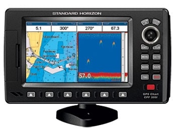
Standard Horizon** has announced two new chart plotters that do double duty as fish finders. “It was time for us to get into the combination market,” says Jason Kennedy, Standard Horizon’s executive vice president. “These are our first combination plotter/fish finders.”
The CPF180i ($599.99) features a 5-inch display and an integrated WAAS GPS receiver. The CPF300i ($999.99) boasts a larger, more easily configured 7-inch, high-resolution screen with 16:9 widescreen display. Both models have a built-in 600-watt, dual frequency (50/200 kHz) fish finder, dual chart windows with independent zoom levels, radar and AIS capability, NMEA input/outputs, and a three-year waterproof warranty.
Standard has had a black box system, but according to Kennedy, center console fishermen often prefer the one-screen installation. “We have a lot more customers who want a chart plotter/fish finder combination,” he says. “Their eyes glaze over when you tell them about a networked system. So we have let other manufacturers handle the networks. Fishermen we talked to would rather have it all in one box so it is easy. This way it’s plug and play, and they are done.”

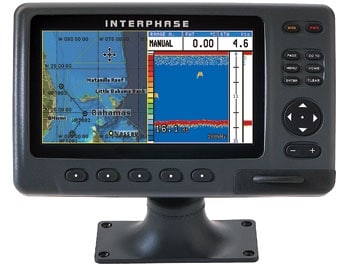
Interphase Technologies had that same angler in mind with the new Chart Master Pro ($999), the company’s first widescreen chart plotter with a dual-frequency color sounder built in. The convenience and simplicity are perfect for center console boats 18 to 30 feet, according to Charles Hicks, president of Interphase.
“Putting that fish finder in with the plotter simplifies the heck out of everything,” he says. “For boats that didn’t want to have all the extra wiring required of a network system, this is perfect. With this one, you plug in the transducer and you are off and fishing.” The Chart Master is supplied with an Airmar 600- watt, dual-frequency transom mount or through-hull transducer that includes speed and water temperature. The series offers two configurations: the internal antenna Chart Master iPro or the external antenna Chart Master Pro.
“The internal antenna is perfect for the open cockpit,” says Hicks. “You don’t have to screw around with the antenna.” The quality and sensitivity of the current crop of GPS receivers eliminates the need for a separate antenna on all but belowdecks installations, Hicks says. Both combo units support Interphase radar, AIS receivers and C-Map cartography.
Though it’s not even one year old, Lowrance’s High Definition System (HDS) has undergone a major upgrade that’s included in every new plotter and is available for free download online for anglers who already have the HDS system.
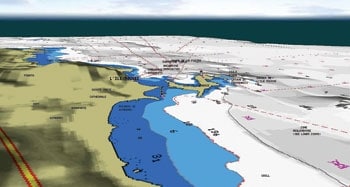
“We are committed to continuously evolving this system,” says James Morrison, product manager for Lowrance. New features include a broadband radar module, a Sirius weather module and TurboView, a major component of the upgrade and big leap forward in the way information is displayed. “The way charting is represented is going through a shift,” says Morrison. “Notable in the upgrade is an enhanced 3-D capability and, overall, more interesting presentation, a result of the **

Lowrance-Navionics** collaboration on TurboView. You can switch seamlessly back and forth between standard chart plotter 2-D for navigating and the 3-D to see what is ahead of you when you are following an edge or following channels and drop-offs. You start to get that Google Earth feel,” says Morrison. Another aspect of the upgrade, the Sirius weather module, can be synchronized as a chart overlay for an aid to finding water that holds fish. “You can do some cool things on the chart with the Sirius weather module,” says Morrison. “With a water temperature overlay, you can line up the temperature gradients over the canyon depth contours.”


