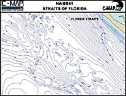
C-MAP recently introduced new bathymetric chart coverage of Florida and expanded coverage of New England that will help fishermen locate underwater seamounts, canyons, wrecks, reefs and drop-offs. The highly detailed bathymetric charts use 1:250,000 scale maps and feature all depth contours found on official NOAA charts down to 10,000′. They show the size, shape and distribution of underwater structure, and list these structures according to commonly used local names. The new charts join C-MAP’s existing bathymetric chart library, which covers Bimini and Walkers Cay in the Bahamas, central and northern Florida offshore waters, and the offshore banks of Massachusetts, Maine and southern Nova Scotia. C-MAP, Mashpee, MA; (800) 424-2627; www.c-map.com


