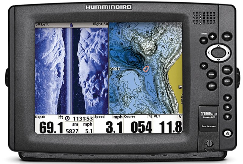
Side-scanning sonar from brands such as Garmin, Humminbird, Lowrance, Raymarine and Simrad scan abeam of the boat, exponentially multiplying bottom coverage and the chances of finding a new structure spot versus conventional down-looking sonar. For comparison, a conventional fish finder with a transducer that broadcasts a 20-degree cone angle straight down covers only a 21-foot circle in 60 feet of water; that expands to a 42-foot circle in 120 feet of water.
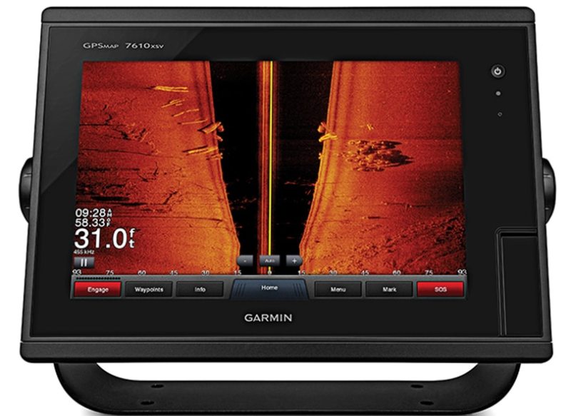
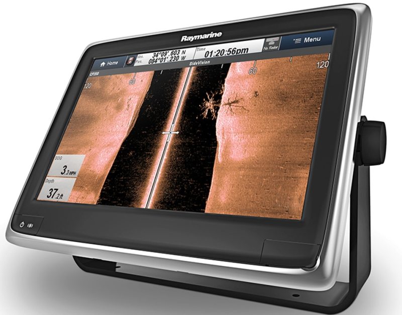
Yet, side-scanning units such as Raymarine’s CP200 CHIRP SideVision Sonar can cover up 600 horizontal feet on either side of the boat, allowing you to view as much as a 1,200-foot swath. Garmin’s CHIRP SideVu covers 1,500 feet with the right transducer. For perspective, that equals five football fields.
Structure Search
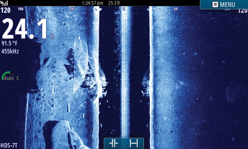
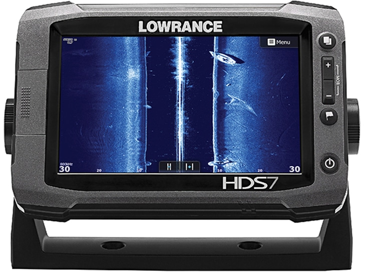
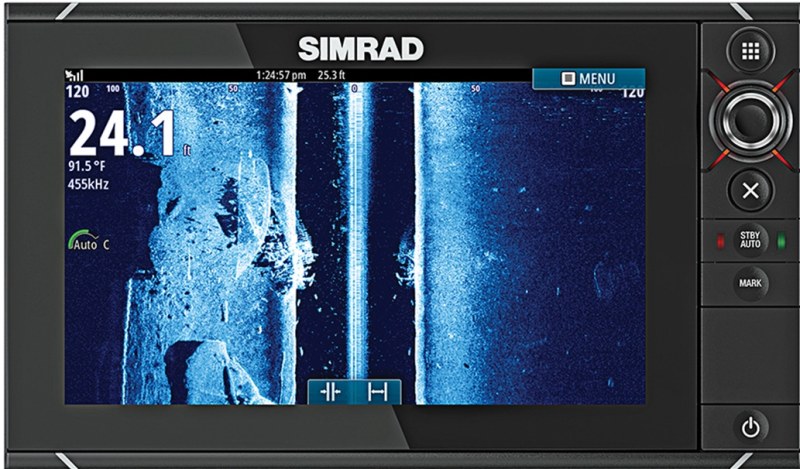
I used side-scanning sonar to locate a number of previously unknown wrecks and rock piles last year. In one instance I searched for new spots one afternoon when fishing was slow. Using a Lowrance HDS12 Gen2 Touch, we set up a three-way split on the display to view StructureScan HD SideScan, the conventional 200-kHz fish finder and the chart plotter.
We set the SideScan to cover 180 feet on either side of the boat at 455 kHz and motored slowly along the coast in 50 to 60 feet of water. After about 15 minutes of searching, an interesting object appeared to our starboard side. The clarity of this return — objects possess a lifelike appearance reminiscent of ultrasound images — told us that this was a pile of underwater rocks, boulders piled on top of one another.
Lock It In
To get a bead on a new spot, the sonar interfaces with the GPS. This allows me to place a cursor on the SideScan sonar image of a rock pile, which brought up the latitude/longitude, as well as a bearing and distance to the object. I then pressed “Go to Cursor,” but I could have used other ways to navigate to the new spot. I could have set the cursor as a waypoint. I could have turned on a feature called Structure Map, which overlays the bottom images on the chart-plotter display. Had we not immediately seen the object, I could have also used TrackBack, an exclusive feature with Lowrance and Simrad, allowing me to scroll backward on the SideScan screen to find the rock pile and then place a cursor on it.
The point is, I didn’t have to zigzag around to get on top of the newly discovered spot. I followed the bearing, and as we came within 50 feet of the cursor, the rock pile appeared on the conventional sonar. I created a new waypoint on the chart plotter and have since returned to this spot to catch fish. With side-scanning sonar, you’ll find more fish-holding habitat and locate those hot spots you always heard about but could never find on your own — until now.
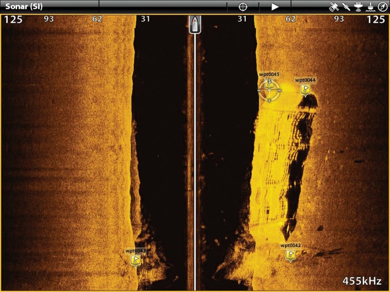
Image Intel