Terrafin
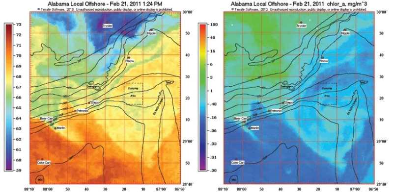
This year marks Terrafin’s 12th anniversary providing offshore satellite imagery to anglers across the country. Starting in 1999 with a handful of regions covering Southern California and Baja, Terrafin now provides sea-surface temperature (SST) and chlorophyll (water color/clarity) charts for the entire U.S. coastline, Hawaii, Alaska, Mexico, the Caribbean and the Pacific coast of Central America. Terrafin subscribers may access all regions at no extra cost, making it ideal for traveling anglers.
Terrafin recently added new data types as well, with altimetry and “cloud-free” SST charts processed daily, along with the more familiar SST and chlorophyll charts. Altimetry indicates areas of upwelling and down welling by measuring the sea-surface height. For more information, visit Terrafin at www.terrafin.com/sstview or call 800-993-0939.