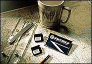
The “Just One Look” chart releases from Navionics include detailed coverage of the coastlines of Florida and the Gulf of Mexico. The Florida chart covers the entire state from Jacksonville to Apalachicola including the Keys, but also incorporates Bimini and the Dry Tortugas. The Gulf chart covers the waters from Mobile, Alabama, to Brownsville, Texas. Both releases include all spot soundings, depth contours and detailed harbor information. Navionics charts are compatible with plotters from many manufacturers, including Raytheon Marine, Furuno, Lowrance, Northstar, SI-TEX, Garmin, ICOM and others. Navionics, Wareham, MA; (800) 848-5896; www.navionics.com