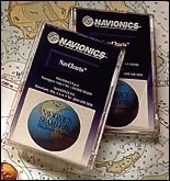
Navionics’ full line ofvector cartography now offers 16 zoom levels, much like thosefound on radar displays. Zoom levels for the charts now startat 1/8 nautical mile and increase at ranges equivalent to mostradar displays. In addition, Navionics also has redesigned itsentire North American portfolio of charts to offer complete coverageof the continental United States, full Port Service guide coverage,a wider selection of chart sizes, and a new pricing structure.All Navionics charts are available in the credit-card-sized Microchart,as well as in the postage-stamp-sized Nav-Chart formats. Navionicscharts are compatible with plotters built by Furuno, GARMIN, ICOM,Lowrance, Northstar, SI-TEX, Trimble, and others. Navionics,Inc., Wareham, MA; (800) 848-5896; www.navionics.com.