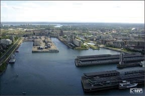
Jeppesen Marine’s newest set of updates to its C-Map MAX charts provides anglers with thousands of Notice to Mariner corrections, expanded coverage into new areas and updated chart features. The release also includes important new chart data for key regions. The Northeast United States MAX chart NA-M026 now offers coverage of New York’s Hudson River in its entirety and all coastal charts for Maine, New Hampshire, Massachusetts, Rhode Island, Connecticut and the Long Island area of New York. Chart NA-M024 has an extended southern border that includes the region around Puerto Vallarta, Mexico. The release also gives MAX users an additional 1,380 quality photos of U.S., Canadian and Caribbean harbors, marinas and inlets, as well as updated 2010 fishing regulations and records, valuable resources for inshore and offshore anglers. www.jeppesen.com/lightmarine

