Marine electronics is one product category that never sits still. Here’s a selection of what’s new at the helm for 2013.
By
Glenn Law
Updated: January 9, 2013
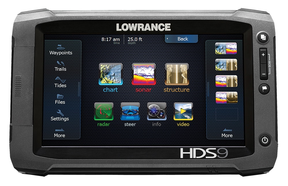
Lowrance has expanded its HDS Gen2 line with the wide-format, touch-screen HDS Gen2 Touch in 7-, 9- and 12-inch sizes, which include a built-in fish finder, chart plotting and integration of Lowrance Broadband Radar, SonicHub marine audio server and LWX-1 Sirius satellite weather/radio. HDS Gen2 Touch fish finders feature both a built-in Broadband Sounder and StructureScan HD SideScan and true DownScan Imaging, TrackBack functionality, and are compatible with Airmar transducers for up to 1 kW operation. The plotter is preloaded with Insight USA inland and coastal cartography, and is compatible with Lowrance Insight HD chart cards; Navionics Platinum+, HotMaps Premium and HotMaps Platinum with Freshest Data; and Fishing Hot Spots Pro. Price: $1,299 to $3,249 Link: www.lowrance.com
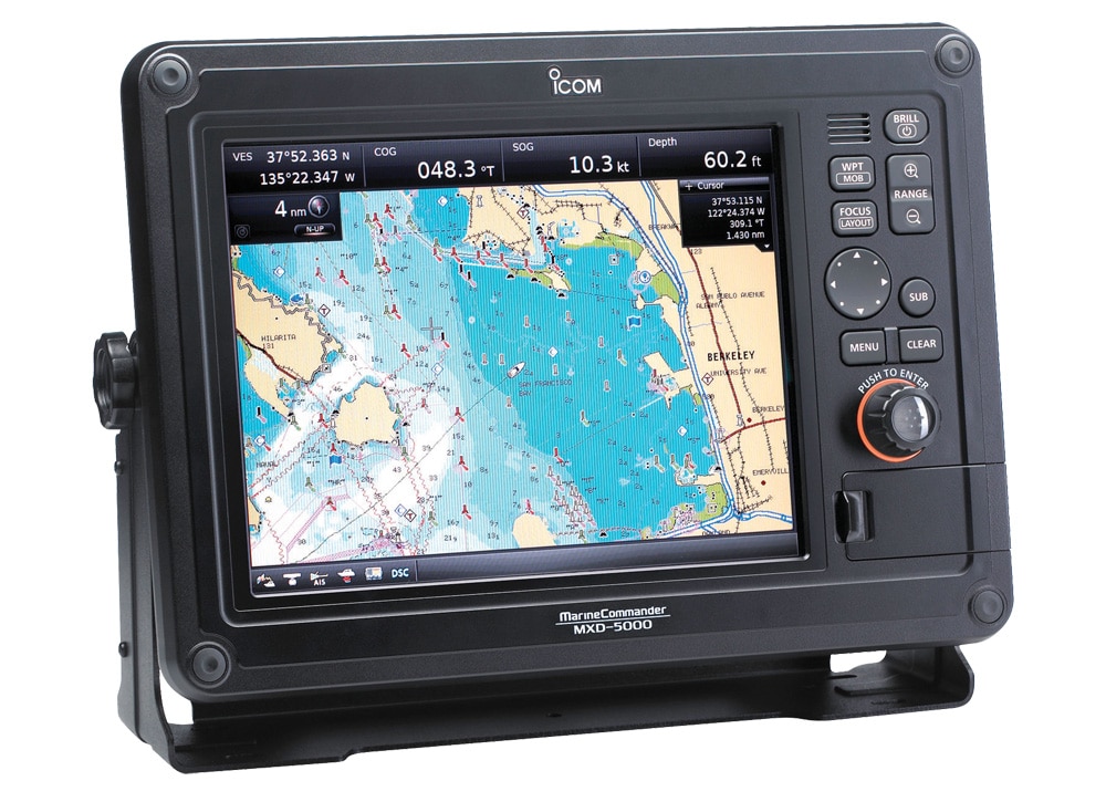
MarineCommander, Icom’s fully customizable navigation system, can be configured to fit any fishing style and budget. Components — including radar, fish finder, AIS and C-MAP charts by Jeppesen — mix and match for a custom electronics suite. When connecting two MarineCommander units via data cable, up to four displays can be used. Each display can be split into four customizable panes, organizing the radar screen, chart plotter, dual-frequency modes and more. USB flash drive and SD card slots are conveniently located on the MarineCommander’s front panel, allowing data backup to a memory stick and compatibility with the C-MAP MAX charts. Price: Components vary; stand-alone or black-box systems start at $1,699 to $3,499 Link: www.icomamerica.com
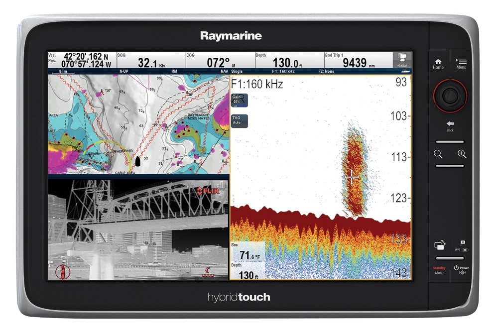
Raymarine has launched the e-165 large-screen multifunction display, the latest addition to the range of e-Series MFDs. The e165 measures 15.4 inches in 16:9 wide format and sits in the same footprint as a traditional 14-inch screen, providing 20 percent more screen for the same helm or dash space. Raymarine’s LightHouse user interface utilizes Wi-Fi and Bluetooth, enabling navigation charts, thermal video, radar or sonar information on the e-Series to be accessed and controlled via RayRemote and RayControl apps from anywhere on board. As well, built-in Wi-Fi combined with Raymarine’s apps enables live video from the e165 to be streamed directly to tablets and smartphones in real time. Price: $6,249.99 Link: www.raymarine.com
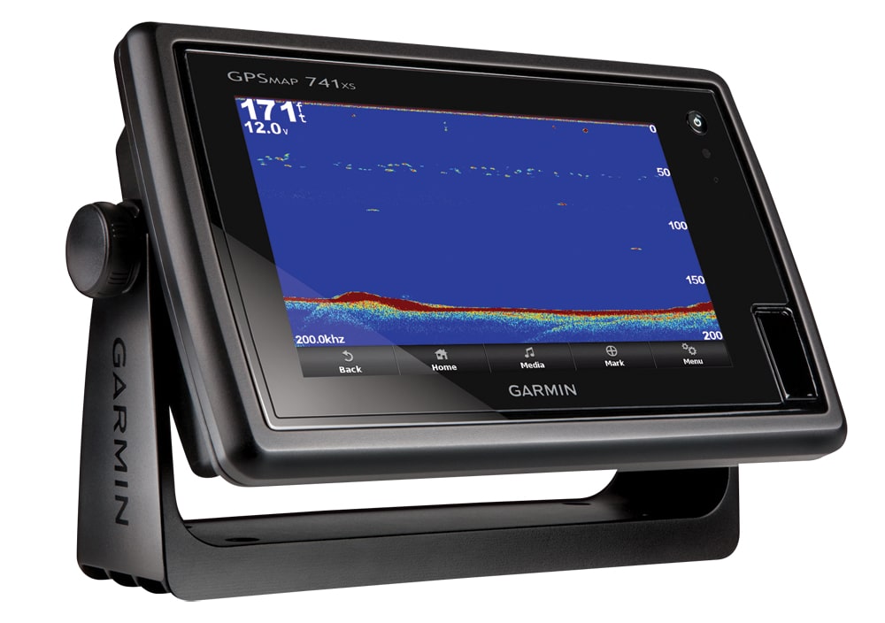
Garmin’s new 741-series plotters offer smooth, fast accuracy in a stand-alone combination unit. Built-in charts make navigating simple. The high-sensitivity 10 Hz GPS/GLONASS receiver updates both position and heading up to 10 times per second for a dramatic improvement in marking and navigating to any of 5,000 waypoints: Speed of update also facilitates smoothness and accuracy of autopilot functions. Integrated fish finding is built on Garmin’s Spread Spectrum CHIRP sonar. When linked to a compatible CHIRP transducer, the screen displays the ultimate in detail-rich imagery of structure, the bottom and targets in the water column. Price: $1,699.99 Link: www.garmin.com
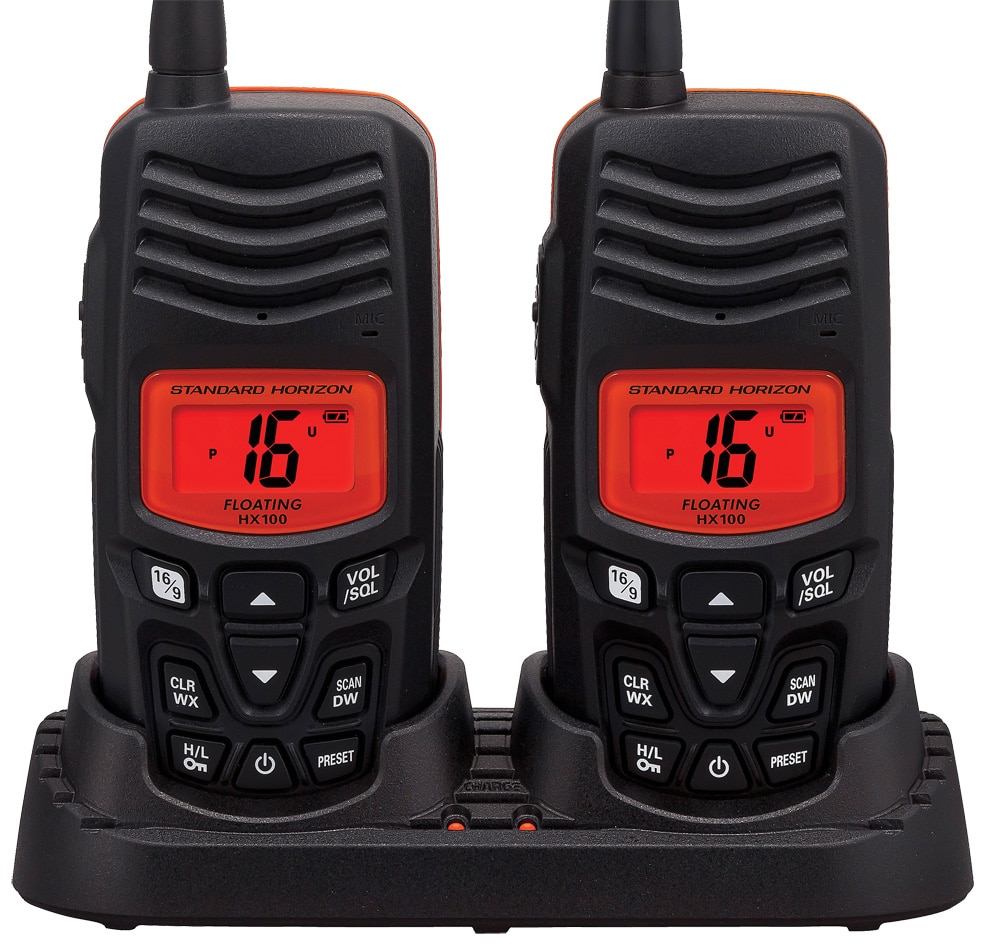
Standard-Horizon’s HX100 Twin Pack offers a ready-made conversation at sea, with two handheld VHF portables that fit a single charger. Radios feature oversize, easy-to-read LCDs and backlit keypads, and a new Ni-MH battery that provides a full day’s worth of operation. Programmable scan, dual watch, Channel 16 priority scan, NOAA weather channels with weather alert, selectable 2.5- and 1-watt transmit power, and a battery-life indicator are a few of the features, and the waterproof units float if dropped overboard. The HX100 Twin Pack comes with batteries, belt clips, 110 VAC trickle charger and a drop-in charging cradle handling both radios at the same time. Price: $149.99 Link: www.standardhorizon.com
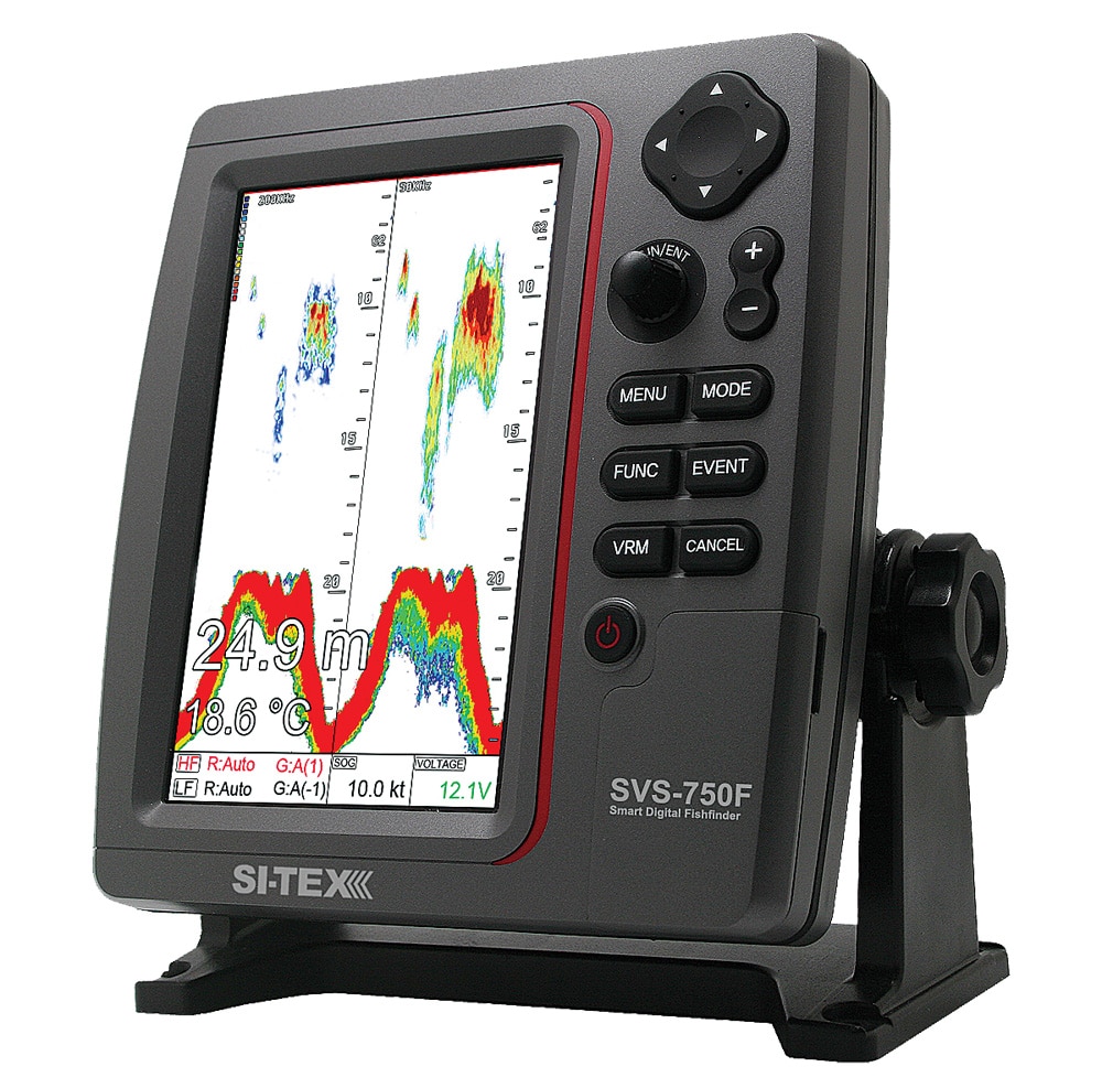
The new SI-TEX SVS-750 Digital Echo Sounder is an affordable color machine combining pro-grade features and fish-finding performance with a large and brilliant high-definition LCD. As well as an advanced sounder, the SVS-750 provides full chart-plotting capabilities with an optional 50-channel GPS receiver and C-MAP MAX cartography. The dual-frequency sounder features a 600-watt output and a 7.5-inch color LCD, vertically oriented to provide maximum sonar resolution. The SVS-750 offers depth ranges to 4,800 feet, and features large, clearly marked controls for easy and intuitive operation. Price: $899 Link: www.si-tex.com
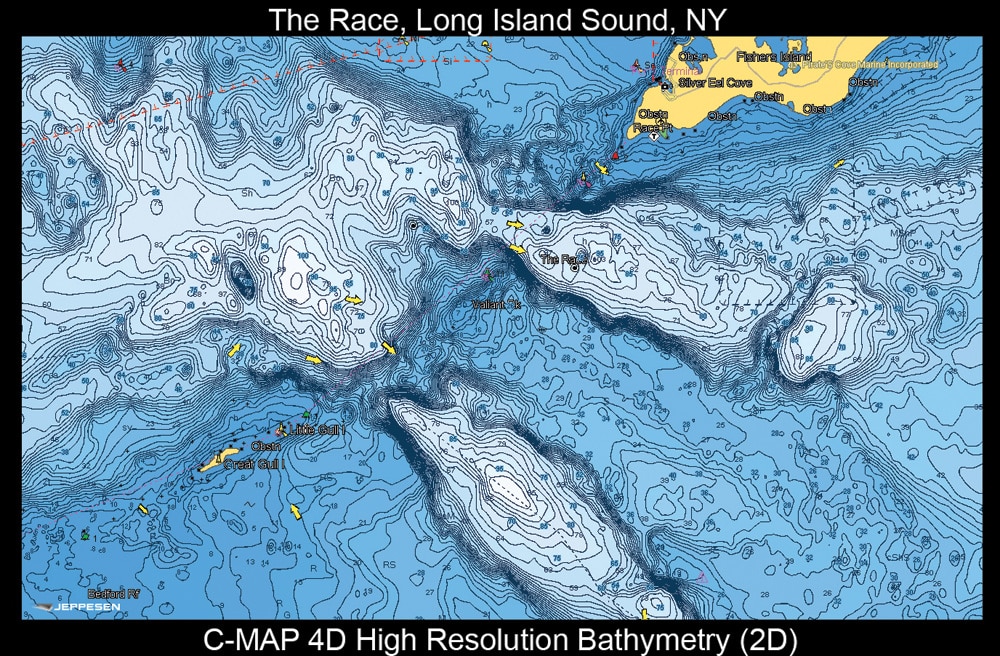
Jeppesen’s C-MAP 4-D and C-MAP MAX electronic charts include a new value-added database of high-resolution bathymetry charts for North American coastal waters. These charts provide unparalleled visual representation of bottom contours and structure for a greater understanding of the underwater topography, with significant improvement in detail and realistic presentation of bottom contour and structure such as ledges, canyons and pinnacles. Charts were developed from a wealth of survey and bathymetric data, then shaded and optimized for rich 2-D and 3-D presentation on high-definition chart plotters, providing a new level of chart detail and presentation on a variety of popular C-MAP 4-D and MAX compatible navigation systems. Price: $149 Link: www.c-map.com
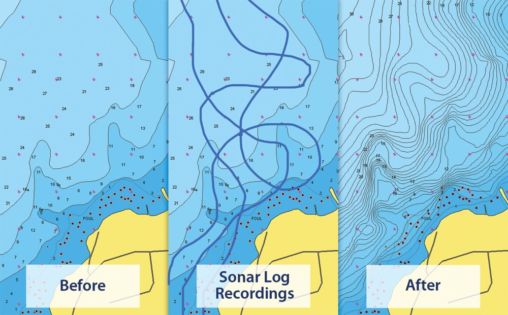
SonarCharts is a new high-definition bathymetry map, created by integrating hydrographic office charts with data from Navionics surveys and sonar logs provided by Navionics Community users. Anyone with a compatible sonar device can log relief, hidden gorges, detailed mountains, canyons or submerged structures never before mapped. Sonar logs can be uploaded online through navionics.com, and revised charts are available within 24 hours. Continually enriched content is updated daily, and is available to iPhone, iPad and GPS. Link: www.navionics.com
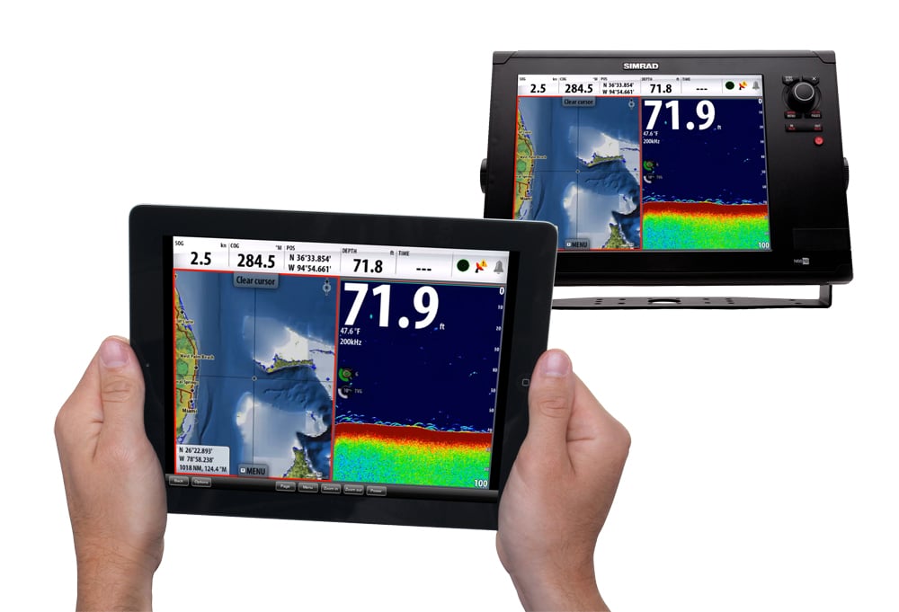
Combining user-friendly mobile software and rugged marine-grade hardware, Simrad’s new GoFree Wireless solution consists of the GoFree Viewer and Control app, and the Simrad WIFI-1 wireless gateway, enabling connectivity between Simrad NSS multifunction displays and tablets, mobile phones and computers. Designed for use with the iPad, the powerful GoFree controller manipulates Simrad NSS functions, in real time, from anywhere on the boat. Replicating the NSS interface, the app enables zooming and panning, radar control, sonar and StructureScan imaging operation, and full interactivity with SonicHub entertainment options. The GoFree Viewer and Control app can be downloaded for free from the Apple app store. Price: WIFI-1 wireless gateway, $199 Link: www.simrad-yachting.com
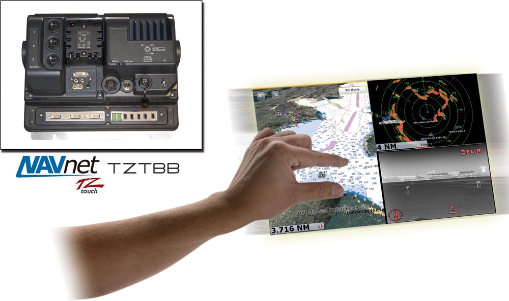
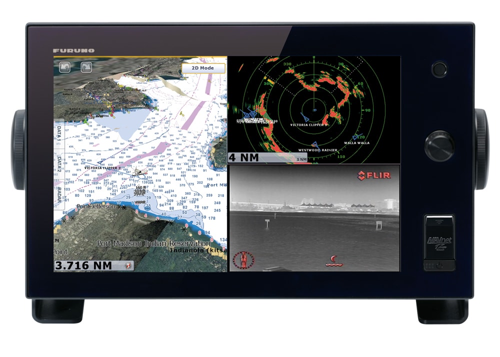
TZTBB, NavNet’s TZtouch Black Box, translates Furuno’s pinch-to-zoom capability, two-finger course rotation, and other multi- and single-touch gestures to any size and aspect multitouch display. Wi-Fi networking accesses free tablet and smartphone apps to remotely control TZtouch. C-Map by Jeppesen vector charts converted to MapMedia format are preloaded onto a 64GB SD card. An optional USB hard drive preloaded with charts and high-res satellite photos eliminates the need for multiple SD cards. Along with up to six displays, it’s compatible with dual-range UHD radar, digital fish finders, AIS, weather fax, Sirius Satellite Weather, IP cameras, as well as NMEA2000 and Furuno CAN bus devices. Link: www.furunousa.com or www.navnet.com
FLIR’s M-Series line of thermal night-vision cameras now respond to Furuno’s Navnet TZTouch MFDs. Camera adjustment, video optimization, and pan and tilt control benefit from remote operation via the touch-screen. The “tap to point” function on the MFD determines the target and moves the camera to it; pinch-to-zoom moves the lens in for a closer look. New TZTouch software enables the automatic tracking of radar and AIS targets, buoys, and people in the water. Furuno Navnet TZtouch displays the camera’s field of view on the chart to simplify interpretation. Link: www.flir.com
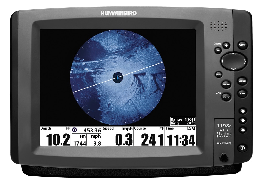
Humminbird’s 360 Imaging provides a complete underwater view with the resolution and detail for which side-imaging technology is known. Each sweep of the sonar covers a 300-foot-diameter circle to produce 70,685 square feet of high-res underwater image around the boat. Viewing options are angler configurable and include the entire circle or segments from the front, back or sides. Split-screen viewing allows display alongside a chart or traditional down-looking sonar. The 360 Imaging accessory includes a Transducer Deployment System that attaches to the boat transom or jackplate to lower the transducer to clear the bottom of the boat and engine. It’s functional at up to 7 mph, and is compatible with existing Ethernet-equipped Humminbird side-imaging equipment. Price: $1,999 Link: www.humminbird.com
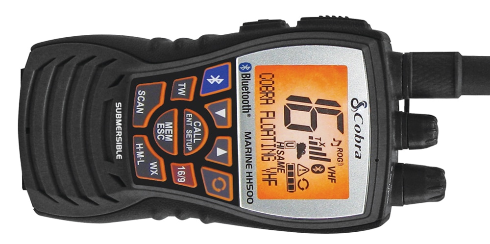
The 6-watt Cobra MR HH500 floating VHF incorporates Bluetooth Wireless Technology for cell-phone operation while the phone is stowed away safe and dry. The dedicated Bluetooth answers phone calls and initiates voice dialing. A combination of dual microphones and noise reduction allows noise-free conversations. The HH500 also incorporates Rewind-Say-Again digital-voice-recorder technology, and NOAA weather alerts providing 24-hour access to audio weather broadcasts and emergency alerts. Waterproofing to 1 meter for 30 minutes is overkill, as lightweight construction with ABS materials enable the radio to float. It’s powered by li-ion/polymer battery technology and is fully gasketed with ergonomic surface geometry. Price: $149.95 Link: www.cobra.com